First Look: Guide to the Geology of Mount Desert Island and Acadia National Park
Categories: Ecology & Sustainability New Release
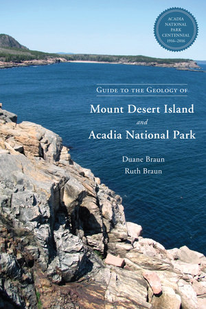
 In their new book, Guide to the Geology of Mount Desert Island and Acadia National Park, Duane and Ruth Braun describe in vivid detail the picturesque scenery and geologic origins of Mount Desert Island (MDI), the home of Acadia National Park. The book takes readers on a powerful journey through time, following the geologic history of the island over the last 550 million years, while also offering readers dozens of self-guided tours, so that they too can witness the incredible landscapes. Below is an adapted first look:
Tags: Nature Writing Ecology Duane Braun Ruth Braun TravelA Synopsis of the Geologic Story of Mount Desert Island
Mount Desert Island (MDI) is on the edge of the Gander terrane, a New Zealand-sized slice of continental crust that split off of the southern continent of Gondwana about 550 million years ago (mya). Gander traveled north to collide with Laurentia, the name for the geologically old core of North America, to form what is now Maine at about 440 mya. Following behind Gander was the Avalon terrane. Avalon collided with Gander starting at about 420 mya. At that time a line of volcanoes formed along the collision zone that today is the coast of Downeast Maine.
MDI was one of those volcanoes, undergoing a series of magma intrusions and violent eruptions for several million years centered around 420 mya. MDI is a prime example of “bimodal volcanism,” the alternating intrusions and extrusions of very hot, fluid basalt magma and less hot, less fluid granite magma. Especially violent eruptions occurred when basalt magma was injected into still molten granite magma. Such violent eruptions formed a caldera ten miles in diameter that occupied most of what is now MDI. That caldera was one-fourth the size of today’s Yellowstone caldera in Wyoming and one-half the size of today’s Long Valley caldera in California, granting it the classification of “super volcano” as some would suggest.
Once MDI’s volcano stopped erupting, collisions from 360 to 260 mya of the Meguma terrane and finally Gondwana itself with North America would uplift and tilt MDI as part of the Appalachian mountain chain. These later mountain-building events would greatly fracture the now cold rigid rock of MDI’s volcano. From when the volcano became extinct at around 420 mya to just a million years or so ago, streams would deeply erode the uplifted volcano forming a V-shaped ridge and ravine landscape. During that period of erosion of four hundred million years orso, two miles of rock would be carved away from MDI. The volcanic form would be entirely removed with only remnants of volcanic ash and lava flows preserved today on its down-tilted southeastern side on Great Cranberry Island and Little Cranberry Island. Standing on MDI today, you are two miles down in what was the magma chamber of the volcano.
Over the last million years or so, continental glaciers as much as five thousand feet thick have flowed over MDI several times and have sculpted the landscape into its present form. The V-shaped ridge and ravine landscape were scoured and smoothed by the glaciers. Ridge crests were rounded and valleys deepened into U-shaped troughs. Today on MDI you are looking at a glacially sculpted landscape of rounded, streamlined peaks separated by elongated lakes in the glacial troughs. Offshore you see rounded islands separated by glacial troughs flooded by the ocean, the Downeast Maine coast.


